Publications & Documents
This policy brief summarises options and strategies for a long-term sustainable financing mechanism/ model for plantation forestry development in Uganda to wean the subsector from short term project-based financing borrowing lessons from Uganda, the region (East Africa), Africa and globally. It was prepared by the Ministry of Water and Environment through the findings of a study supported by the Uganda Investing in Forests and Protected Areas for Climate-Smart Development (IFPA-CD) Project with funding from the Word Bank and Government of Uganda.
ENVIRONMENTAL and SOCIAL COMMITMENT PLAN (ESCP) June 15, 2026
Investing in Forests and Protected Areas for Climate Smart Development (P 170466),Updated ENVIRONMENTAL and SOCIAL COMMITMENT PLAN (ESCP) June 15, 2026
ToR for Physical planning development plan
TERMS OF REFERENCE FOR CONSULTANCY SERVICES FOR PREPARATION OF PHYSICAL DEVELOPMENT PLANS (PDPs) FOR THE SUB-COUNTIES AND TOWN COUNCILS HOSTING KABUYANDA AND MATANDA IRRIGATION SCHEMES IN ISINGIRO AND KANUNGU DISTRICTS RESPECTIVELY
ToR-Titling Demarcation Kabuyanda_Matanda
CONSULTANCY SERVICES FOR DEMARCATION, CADASTRAL SURVEY AND TITLING OF ACQUIRED PROJECT CORRIDORS AT KABUYANDA AND MATANDA IRRIGATION SCHEMES IN ISINGIRO AND KANUNGU DISTRICTS RESPECTIVELY
Advert for Demarcation and cadastral surveys
CONSULTANCY SERVICES FOR DEMARCATION, CADASTRAL SURVEY AND TITLING OF ACQUIRED PROJECT CORRIDORS AT KABUYANDA AND MATANDA IRRIGATION SCHEMES IN ISINGIRO AND KANUNGU DISTRICTS RESPECTIVELY
Terms_of_reference Kabauyanda off farm
TERMS OF REFERENCE FOR SUPERVISION OF CONSTRUCTION WORKS FOR KABUYANDA OFF-FARM NETWORK WITHIN THE BLOCK.
Advert for off farm supervision
CONSULTANCY SERVICES FOR CONSTRUCTION SUPERVISION OF KABUYANDA OFF-FARM NETWORK WITHIN THE BLOCK
ToR-Construction_Supervision_of_Scheme_Roads_and_Buildings
TERMS OF REFERENCE FOR SUPERVISION OF CONSTRUCTION WORKS FOR KABUYANDA SCHEME ROADS, SCHEME BUILDINGS AND SANITATION FACILITIES.
Advert for Scheme Roads Supervision
CONSULTANCY SERVICES FOR SUPERVISION OF CONSTRUCTION WORKS FOR KABUYANDA SCHEME ROADS, SCHEME BUILDINGS AND SANITATION FACILITIES
The Government of Uganda (GoU) is implementing the “Investing in Forests and Protected Areas for Climate-Smart Development (IFPA-CD or Project) Project”. The project is financed by the International Development Association (IDA) of the World Bank (with financing of US$148.2 million equivalent). The implementation of the project is led by the Ministry of Water and Environment (MWE), Uganda Wildlife Authority (UWA), and the National Forestry Authority (NFA). As of August 31, 2025, the NFA has been mainstreamed into MWE. Therefore, throughout this document, all subsequent references to this entity will be noted as MWE/ex-NFA to accurately reflect this organizational change. The project was approved in April 2020, became effective in August 2021, and closes on June 30, 2026.
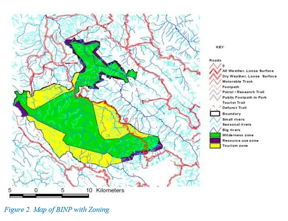
Vulnerable and Marginalized Groups Plan for the Batwa around the Bwindi Impenetrable National Park
The BINP was originally established as the Bwindi (Impenetrable) Forest Reserve in 1932. Later it was established as a Gorilla Sanctuary by General Notice No. 584 of 1961 and amended by Legal Notice No. 53 of 1962, Legal Notice No. 567 of 1962 and Statutory Instrument No. 10 of 1964 (Protected Area System Plan for Uganda Vol. 4, 1999). The Impenetrable Forest came under National Park status by resolution of the National Resistance Council of 13th August 1991 and became known as BINP under Statutory Instrument Supplement No.3 of 1992.
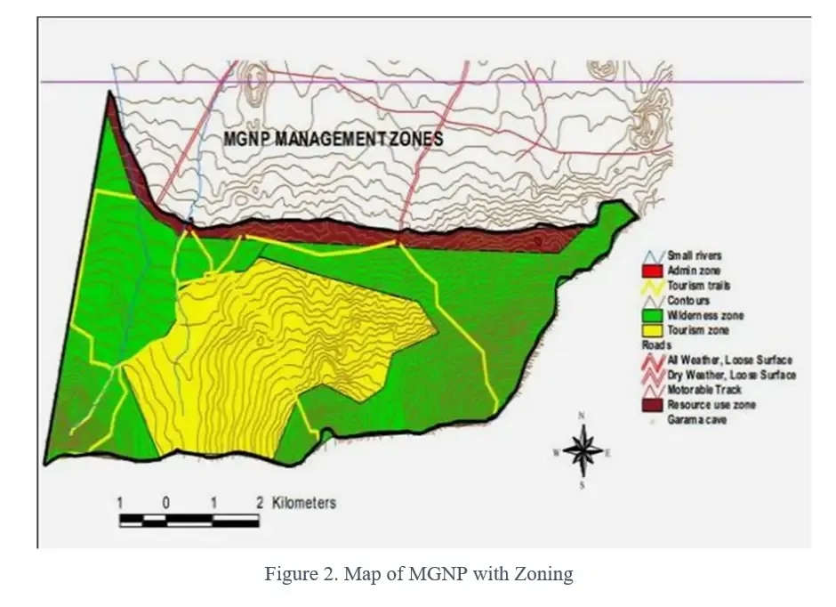
Revised Vulnerable and Marginalized Groups Plan for the Batwa around the Mgahinga Gorilla National Park
MGNP is located in the extreme south-western corner of Uganda between latitude -1.33 to -1.38 South and longitude 29.6o to 29.7o East. The area was originally established as a Forest Reserve. A Sanctuary to protect gorillas was established by Legal Notice 21 of 1930, the area being upgraded to Game Reserve Status by Statutory Instrument (SI) No. 216 of 1964 (substituted by SI No. 136 of 1965). The National Park was established by SI No. 27 of 1991, amended by SI No. 3 of 1992. At 33.7 km2, MGNP is Uganda’s smallest national park. By the late 1980s the area was severely encroached. After the area was upgraded to a National Park in 1991 the encroaching families were relocated.
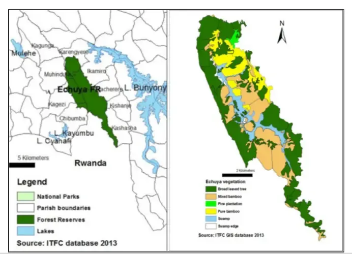
Vulnerable and Marginalized Groups Plan for the Batwa around Echuya Central Forest Reserve
The Echuya Forest Reserve was constituted in 1939 and was first gazetted and declared as undemarcated crown forest of 4,144 ha in 1941. It was demarcated in 1944 and re-gazetted as a Central Forest Reserve by Legal Notice No. 41 of 1948 with an area of 3,403 Ha. Management is vested in the Ministry of Water and Environment (ex NFA) under Section 54(i) of the National Forestry and Tree Planting Act 2003, while Section 33(1) stipulates rights and privileges of communities.
Terms of reference for ESIA in Nyimur
TERMS OF REFERENCE FOR CONSULTING SERVICES FOR COMPREHENSIVE REVIEW AND UPDATING OF ESIA STUDIES FOR NYIMUR IRRIGATION SCHEME IN LAMWO DISTRICT
Lower Sironko Micro-catchment covers an approximate total area of 93.67 km2 in Sironko district. The Micro-catchment consists of the following administrative units: Budadiri T/C, Buhugu Sub-county, Bukhulo Sub-county, Bukiise Sub-county, Bukiyi Sub-county, Buteza Sub-county, Buwalasi Sub-county, Buwasi Sub-county, Buyobo Sub-county, Nalusasa Sub-county and Sironko T/C .
Lower Muyembe Micro_Catchment CRAP
Lower Muyembe Micro-catchment covers an approximate total area of 49.55 km2 in both Bulambuli and Kapchorwa districts. The Micro-catchment consists of the following administrative units: Amukol Sub-county, Buginyanya Sub-county, Bulambuli T/C, Bulegeni Sub-county, Bulegeni T/C, Bumugibole Sub-county, Chepteret Sub-county, Kamu Sub-county, Kapsinda Sub-county, Kaserem Sub-county, Kawowo Sub-county, Masiira Sub-county, Muyembe Sub-county, Nabongo Sub-county, Sipi Sub-county and Sisiyi Sub-county.
Lower Simu Climate Resilient Action Plans March 2026
Lower Simu Micro-catchment covers an approximate total area of 55.16 km2 in Bulambuli district and partly Sironko district. The Micro-catchment consists of the following administrative units: Bukhalu, Bukyabo, Bulaago, Bulegeni, Bulegeni T/C, Buluganya, Bumasobo, Butandiga, Kamu, Lusha, Muyembe, Simu and Sisiyi.
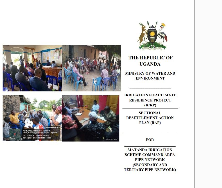
MATANDA IRRIGATION SCHEME_COMMAND AREA SECTIONAL RAP
MATANDA IRRIGATION SCHEME_COMMAND AREA SECTIONAL RESETTLEMENT ACTION PLAN (RAP)