
Upper Nile Water Management Zone

REGIONAL MANAGER
Mr. Kerudong Paskwale
DEPARTMENT
Water Resource Planning and RegulationAbout Upper Nile Water Management Zone
The UNWMZ encompasses almost entirely the northern region of Uganda. It has an extension of about 50,000km2 and includes the Ugandan part of three river catchments that form the Upper Nile Water Management Zone: Albert Nile, Aswa, and Kidepo.The Albert Nile River stems from Lake Albert and flows to the north through northern Uganda, then at the South Sudanese border it becomes the Bahr al Abyad, or the White Nile. The Aswa River is a major river in north-eastern Uganda which flows northwest into South Sudan where it joins the White Nile. The river originates from the hills in the Upper Nile region and flows through Lira District and marks the border between the Districts of Pader and Gulu. The main tributaries of Aswa are the Agago and Pager rivers. The course of the Aswa River delineates most of the border between the District of Atiak and Kitgum before crossing into South Sudan, east of the border town of Nimule, and joining the White Nile about 10 miles northwest of Nimule.The Kidepo River is a tributary of the Pibor River that runs in eastern South Sudan along the border between South Sudan and Ethiopia. Pibor River flows north for about 320 kilometres and joins the Akabo and Baro rivers to form the Sobat River which is a southern tributary of the White Nile.
1.2 Water Resources Planning and Management
Water Resources Planning and Management is implemented through a Catchment Based Integrated Water Resources Management approach (CbIWRM) that places stakeholders at the centre of developing and managing water resources in an integrated and co-ordinated manner. The (CbIWRM) framework aims at moving water resources management closer to where action is needed at the lowest appropriate level based on the hydrological units called Catchments. Within each WMZ, there exists a number of Catchments, sub-catchments and micro-catchments for which tools and capacities for management of water resources are developed. UNWMZ has three catchments; The biggest is Aswa catchment covering Lango, Acholi, part of Karamoja and Teso Sub-regions regions; followed by Albert Nile covering West Nile Sub-Region and part of Acholi and the smallest is Kidepo catchment (upstream) covering Karamoja sub-region. Currently, UNWMZ has prepared two Catchment Management Plans (CMPs); Aswa and Albert Nile, one Sub-Catchment Management Plan Ayila Abongo and eight Micro Catchment Management Plans (MCMPs). These plans contain critical water resources issues, challenges, threats, opportunities and potential measures aimed at protecting and restoring the catchment while improving peoples’ livelihoods.
Critical to water resources management is monitoring the resource, which entails continuous collection and analysis of surface and groundwater observation data for quality and quantity. In addition, water use regulation through the issuance of permits is being carried out at the regional level. Key achievements include: 29(GW9, SW20) water resources monitoring stations operated and maintained, and Honoria for gauge readers paid, flood assessment undertaken in the districts of Amuru, Adjumani, Obongi, Madi-Okollo, Pakwach, Nwoya and Oyam to establish a threshold for flood-prone areas, Collected 1374 drinking water and wastewater samples were collected and analyzed and a total of shs.43,609,000 NTR collected, 45 water abstraction and wastewater discharge permit holders were monitored for compliance with permit conditions. 57 Illegal water abstractors and wastewater dischargers were identified and sensitized to acquire permits.
2.0 Catchment Management Challenges
The common catchment management challenges stressing water resources experienced in Aswa and Albert Nile catchments include:
· River bank degradation due to sand mining, cultivation of crops, uncontrolled livestock access and charcoal burning
· Wetland degradation due to agricultural expansion and cattle grazing (c) Deforestation and degradation of agricultural landscape
· Poor farming practices that promote soil erosion
· Inadequate harvesting of storm water from roadsides leading to soil erosion and silting/sedimentation of rivers and streams.
2.1 Potential Priority Measures
· Stakeholders’ identification, engagement, and build capacity building in undertaking catchment-based and community driven catchment management measures.
· Support communities to restore degraded hotspot wetlands and riverbanks
· Support communities to implement soil and water conservation measures on priority hotspots in the catchment.
· Support communities to restore deforested and degraded land through community tree growing on individual farmers’ land, public land and riverbanks.
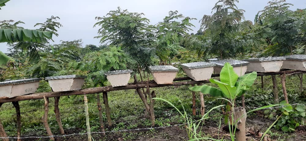
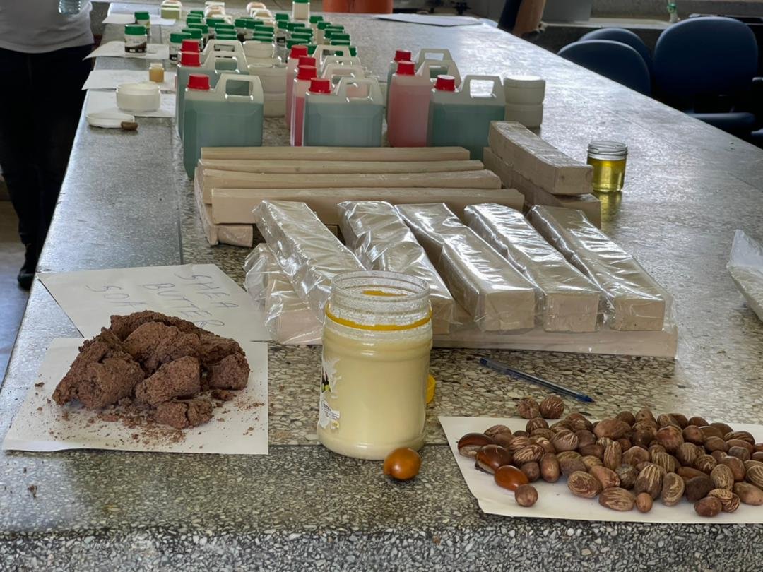
· Support communities to establish and promote alternative income generating activities for improved livelihoods
The catchment management challenges and potential priority measures have been consolidated in the CMPs and used as resource mobilization tool. This has attracted support from various donor agencies such as;
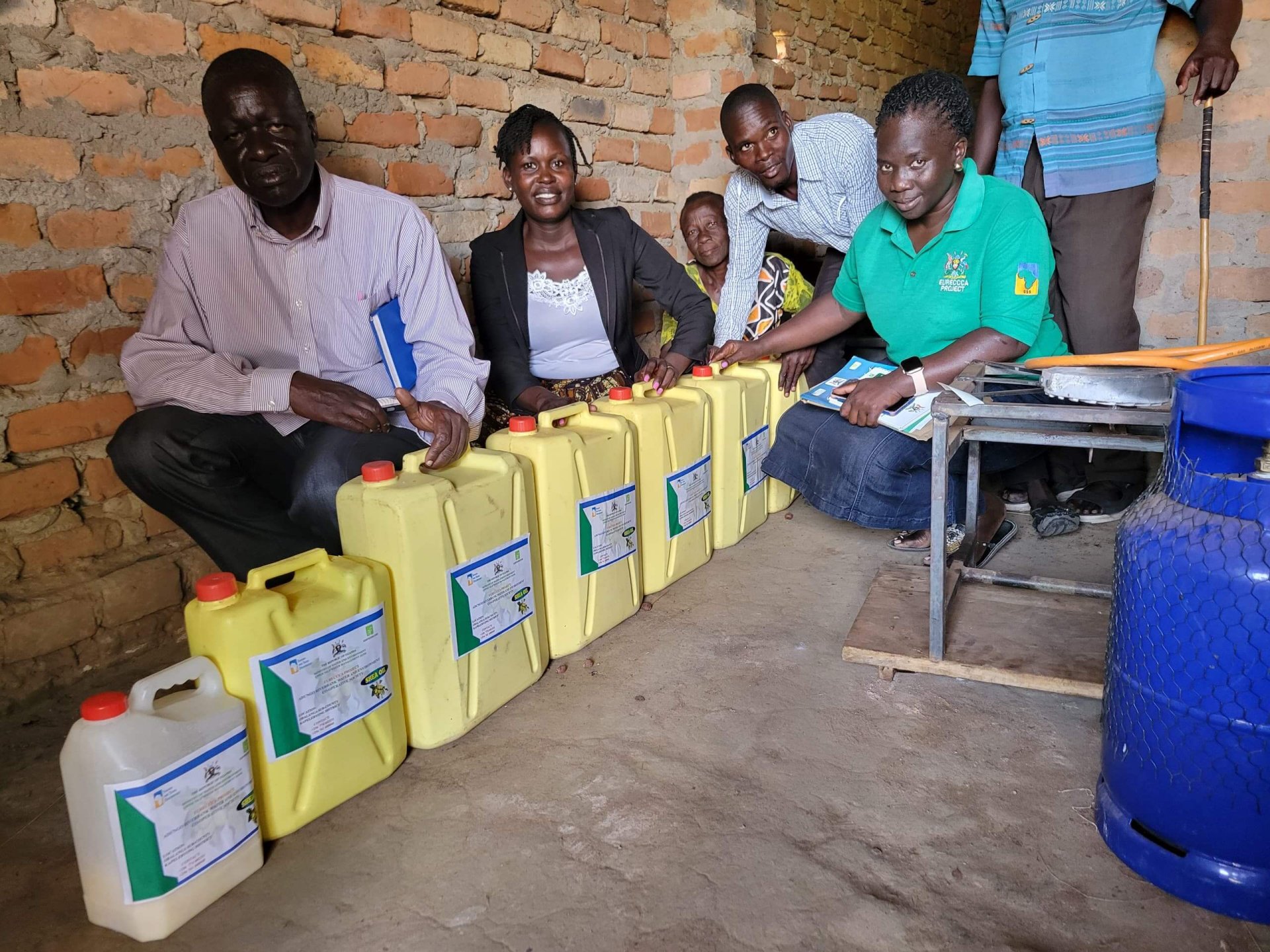
· Adaptation fund through Sahara Sahel funded climate change resilient project known as “Enhancing Resilience of Communities to Climate Change through Catchment Based Integrated Management of Water and Related Resources in Uganda’’ (EURECCCA) Project implemented in Agago, Aswa1 and Pagermatidi sub-catchments in Aswa catchment,
· World Bank funded Integrated Water Management Development Project (IWMDP) in Aswa II and Kochi sub-catchments in Aswa and Albert Nile catchments respectively,
· Government of Uganda through the Water Management Zone II Project (WMZ II) funded catchment management priority measures in Ayila Abongo sub-catchment in Albert Nile. Below is the progress of the above project performance in FY 2023/2024.
About Upper Nile Water Management Zone
The UNWMZ encompasses almost entirely the northern region of Uganda. It has an extension of about 50,000km2 and includes the Ugandan part of three river catchments that form the Upper Nile Water Management Zone: Albert Nile, Aswa, and Kidepo.The Albert Nile River stems from Lake Albert and flows to the north through northern Uganda, then at the South Sudanese border it becomes the Bahr al Abyad, or the White Nile. The Aswa River is a major river in north-eastern Uganda which flows northwest into South Sudan where it joins the White Nile. The river originates from the hills in the Upper Nile region and flows through Lira District and marks the border between the Districts of Pader and Gulu. The main tributaries of Aswa are the Agago and Pager rivers. The course of the Aswa River delineates most of the border between the District of Atiak and Kitgum before crossing into South Sudan, east of the border town of Nimule, and joining the White Nile about 10 miles northwest of Nimule.The Kidepo River is a tributary of the Pibor River that runs in eastern South Sudan along the border between South Sudan and Ethiopia. Pibor River flows north for about 320 kilometres and joins the Akabo and Baro rivers to form the Sobat River which is a southern tributary of the White Nile.
1.2 Water Resources Planning and Management
Water Resources Planning and Management is implemented through a Catchment Based Integrated Water Resources Management approach (CbIWRM) that places stakeholders at the centre of developing and managing water resources in an integrated and co-ordinated manner. The (CbIWRM) framework aims at moving water resources management closer to where action is needed at the lowest appropriate level based on the hydrological units called Catchments. Within each WMZ, there exists a number of Catchments, sub-catchments and micro-catchments for which tools and capacities for management of water resources are developed. UNWMZ has three catchments; The biggest is Aswa catchment covering Lango, Acholi, part of Karamoja and Teso Sub-regions regions; followed by Albert Nile covering West Nile Sub-Region and part of Acholi and the smallest is Kidepo catchment (upstream) covering Karamoja sub-region. Currently, UNWMZ has prepared two Catchment Management Plans (CMPs); Aswa and Albert Nile, one Sub-Catchment Management Plan Ayila Abongo and eight Micro Catchment Management Plans (MCMPs). These plans contain critical water resources issues, challenges, threats, opportunities and potential measures aimed at protecting and restoring the catchment while improving peoples’ livelihoods.
Critical to water resources management is monitoring the resource, which entails continuous collection and analysis of surface and groundwater observation data for quality and quantity. In addition, water use regulation through the issuance of permits is being carried out at the regional level. Key achievements include: 29(GW9, SW20) water resources monitoring stations operated and maintained, and Honoria for gauge readers paid, flood assessment undertaken in the districts of Amuru, Adjumani, Obongi, Madi-Okollo, Pakwach, Nwoya and Oyam to establish a threshold for flood-prone areas, Collected 1374 drinking water and wastewater samples were collected and analyzed and a total of shs.43,609,000 NTR collected, 45 water abstraction and wastewater discharge permit holders were monitored for compliance with permit conditions. 57 Illegal water abstractors and wastewater dischargers were identified and sensitized to acquire permits.
2.0 Catchment Management Challenges
The common catchment management challenges stressing water resources experienced in Aswa and Albert Nile catchments include:
· River bank degradation due to sand mining, cultivation of crops, uncontrolled livestock access and charcoal burning
· Wetland degradation due to agricultural expansion and cattle grazing (c) Deforestation and degradation of agricultural landscape
· Poor farming practices that promote soil erosion
· Inadequate harvesting of storm water from roadsides leading to soil erosion and silting/sedimentation of rivers and streams.
2.1 Potential Priority Measures
· Stakeholders’ identification, engagement, and build capacity building in undertaking catchment-based and community driven catchment management measures.
· Support communities to restore degraded hotspot wetlands and riverbanks
· Support communities to implement soil and water conservation measures on priority hotspots in the catchment.
· Support communities to restore deforested and degraded land through community tree growing on individual farmers’ land, public land and riverbanks.
· Support communities to establish and promote alternative income generating activities for improved livelihoods
The catchment management challenges and potential priority measures have been consolidated in the CMPs and used as resource mobilization tool. This has attracted support from various donor agencies such as;
· Adaptation fund through Sahara Sahel funded climate change resilient project known as “Enhancing Resilience of Communities to Climate Change through Catchment Based Integrated Management of Water and Related Resources in Uganda’’ (EURECCCA) Project implemented in Agago, Aswa1 and Pagermatidi sub-catchments in Aswa catchment,
· World Bank funded Integrated Water Management Development Project (IWMDP) in Aswa II and Kochi sub-catchments in Aswa and Albert Nile catchments respectively,
· Government of Uganda through the Water Management Zone II Project (WMZ II) funded catchment management priority measures in Ayila Abongo sub-catchment in Albert Nile. Below is the progress of the above project performance in FY 2023/2024.
Photo Gallery
Related News & Updates
LAUNCH OF THE GEF - FUNDED PROJECT: “FOSTERING WATER SECURITY AND CATCHMENT RESILIENCE IN UGANDA’s CATTLE CORRIDOR”
April 29, 2026

TThe 5th Cohort of the WRI Mentorship Program: A Journey of Growth, Leadership, and Impact
March 04, 2026

Launch of the Groundwater for Advancing Resilience (G4DR) Project in Uganda
November 04, 2025